TOUT A ÉTÉ TROP VITE. #Tibet #Nepal
It wasn't an earthquake that brought down the mountain—it was literally the mountain that produced an earthquake.
8 chapters
- The Earthquake That Wasn't OneOverviewOn August 26, 2026 at 8:37 AM Nepal time, seismometers recorded a 5.2 magnitude tremor on the Richter scale, initially interpreted as an earthquake in the Himalayas.Key Facts• By reanalyzing wave patterns, particularly long waves, seismologists understood that the energy came not from a fault but from the surface. • A glacier broke loose: several million tons of ice and rock fell from over 1 km high. • It wasn't an earthquake that brought down the mountain—it was the mountain that produced an earthquake.ConsequencesTwo valleys and two countries were hit by a torrent that is not a typical flood; there was some rain on the Tibetan side but rain was not the cause.Human TollThe toll reached hundreds of dead and missing, with at least 100,000 people affected: Nepalis, Tibetans, Indian pilgrims and travelers from everywhere, including French nationals.
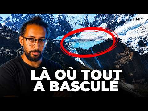
- Link by Link: The Setting and SequenceGeographic ContextThe event occurred in Rasuwa district, about a hundred kilometers north of Kathmandu, at the Chinese border, where the Bhote Koshi river (becoming the Trishuli in the plains) receives the Langtang Khola tributary.Chain of Events• First link: at 5,200 m altitude, a landslide tears away a section of rock face that carries a hanging glacier with it. • Second link: the mass falls about 1,200 m, releasing enormous energy that melts part of the ice through friction. • Third link: ice, rocks and sediments form a natural dam in the Langtang Khola riverbed, creating a lake in minutes. • Fourth link: dam rupture, triggering a debris flow—a mixture of water and ice with density close to liquid concrete. • Fifth link: the debris flow spreads via Langtang Khola then Bhote Koshi, devastating the Kyirong border post on the Tibetan side and the Syabrubesi area on the Nepali side.Key DetailsBetween the collapse at 5,200 m and the first villages hit, only minutes elapsed; a camera captured a 6-story building disappearing in seconds.Scientific InterpretationA researcher from Grenoble, Christen Cook, noted that the signal resembled that of the Chamoli disaster in India in 2021, where the same scenario had occurred.
- Not a Classic GLOF: A Valley with a Short MemoryKey ConceptA GLOF (Glacial Lake Outburst Flood) refers to a lake held back by moraine or ice whose dam suddenly gives way; many scientists initially thought this scenario by reflex.Essential DifferenceUnlike a classic GLOF, there was no pre-existing lake in satellite images: the lake was created by the avalanche itself in record time.Valley Precedents• April 25, 2015: the Gorkha earthquake (magnitude 7.8) triggers an avalanche that buries the village of Langtang, killing several hundred. • July 8, 2025: a lake formed in weeks on a glacier drains suddenly, destroying the Friendship Bridge between Nepal and China, killing 9 on the Nepali side.ConclusionIn 2015 the earthquake triggered the avalanche; in 2026 the avalanche produced the seismic signal: an inverted causality that explains why seismologists took time to understand.
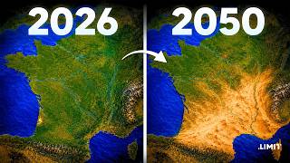
- A World Beyond Planetary BoundariesHuman Stakes• Since the 2015 earthquake, Rasuwagadhi became the main overland gateway between Nepal and China. • The road to Mount Kailash, sacred to Hindus and Buddhists, passes through this valley. • Late August is high season, explaining the presence of many Indians, Americans and Britons among the missing. • August 26 preceded Janai Purnima festival, with hundreds of Nepalis heading to the sacred Gosaikunda lake.The Third PoleThe region is nicknamed the 'Third Pole', the largest ice reserve outside the Arctic and Antarctica, from which 10 major rivers originate and on which 2 billion people directly depend.Weakening Mechanism• Permafrost (rock frozen deep above 4,000–5,000 m in the Himalayas) acts as cement between rock fissures. • It has warmed about 1°C per decade, over 3°C since measurements began. • When ice melts, the cement disappears and pieces held for millennia can fall. • A hanging glacier adheres to rock as long as the base is frozen; above 0°C, liquid water lubricates the interface and the glacier can break loose.Key Figures• One ton of ice falling 1,200 m releases about 12 MJ, equivalent to 14 kg of TNT. • According to ICIMOD (2023), glaciers in the region lost mass 65 times faster in the 2010s than in the 2000s. • In a high-emissions scenario, up to 80% of glacial volume could disappear by century's end. • A study of Langtang shows that since 1815, the valley has lost 40% of its ice, with 8 glaciers gone and fragmentation concentrated around 5,200 m—exactly the altitude of August 26's collapse.
- Looking in the Wrong DirectionCurrent SystemFlood warning systems (in Nepal and elsewhere) rely on stations measuring river height and rain-runoff models—a robust logic but founded on the assumption that water comes from the sky.Revealed LimitationOn August 26, that assumption failed: instruments watched the sky while danger came from the rock.Adaptation Paths• Near real-time satellite monitoring of hanging glaciers and lakes, including newly formed ones. • Dedicated seismic networks capable of distinguishing glacier movement from earthquakes. • Devices already in place in the French Alps, where resources are greater.Funding ChallengeNepal, one of the least-contributing countries to climate warming, is among the most exposed but cannot monitor its 3,000 lakes and hundreds of hanging glaciers due to budget constraints—a central question at COP debates.
- Maladaptation: The Hydropower CaseEnergy ContextNepal, lacking oil, coal or gas, relies on hydropower as an economic lever, with several thousand MW installed and an export agreement with India.Structural VulnerabilityNearly all plants are run-of-river (intake, tunnel, drop, turbine, no large dam or reservoir), built in steep gorges—exactly the corridor used by debris flows.Impact MeasuredOver 12% of Nepal's national hydroelectric capacity was affected on August 26—an event lasting minutes in a single valley impacting the entire country.Important CaveatThe author clarifies not being against hydropower, but stresses the need to rethink where infrastructure is located in a world where the mountain holds together differently than before.
- Four Places, One MechanismComparable Cases• Chamoli, India, February 7, 2021 • Kolka-Karmadon, Russian Caucasus, September 20, 2002 • Marmolada, Dolomites, July 3, 2022 • Blatten, Switzerland, May 28, 2025The Alps Case• The Alps have warmed about 2°C since pre-industrial times—roughly twice the global average. • Swiss glaciers lost about 10% of their volume in 2022 and 2023 alone. • Permafrost between 2,500 and 3,500 m (zone of huts, routes, cable cars) is becoming critical.An Observation LaboratoryThe Himalayas is a laboratory a few years ahead of what is already happening elsewhere globally, notably at Chamonix.Blatten: Same Physics, Different ResponseAt Blatten, the village was evacuated 10 days before collapse thanks to sensors and radars monitoring the rock face, resulting in only one missing person—thanks to massive investment in monitoring, public funding and scientific research.
- The Double Blow and ConclusionSummary'Human limits' collide with 'planetary boundaries exceeded': a valley loses its trade route, its bridge, part of its electricity and its pilgrimage season in minutes, without anyone choosing or voting for it.Capacity ComparisonAt Blatten, helicopters, hospitals 30 minutes away, bypass roads and insurance quickly took over; in Nepal, Rasuwa's only road is buried in mud, the bridge destroyed, and rescue must reach villages on foot or by air, with a per-capita income far below Switzerland's.Lingering RiskIce blocks remain stuck upstream and could melt and trigger another debris flow—a risk to monitor closely that may already have materialized by the video's release.Final MessageThe author invites thought for Nepal and Tibet, also impacted, and closes the video by reflecting on the term 'Third Pole' as a striking discovery from this investigation.